NPO Uralgeopole specializes in conducting geophysical surveys to address geotechnical, hydrogeological and environmental problems:
Search minerals and solving problems associated with this

- determining the depth of the roof of rocky soils,
- cut division into lithological layers;
- Mapping permafrost;
- the identification and delineation of hydrocarbon accumulations in the man-made part of the near-surface geological environment;
- Search and geometrization subsurface gas hydrocarbon accumulations
- many others
Water search and solution of problems related
- mapping of buried river valleys;
- the identification and delineation of karst areas;
- determining the position of the groundwater level;
- determine the direction and speed of groundwater;
- the identification and delineation of anomalous areas
- related salinization of fresh groundwater and many others
Environmental monitoring and forecasting

- establishing and tracking tectonic faults and fracture zones;
- detection and monitoring control areas of development of dangerous geological processes: karst, landslides, thawed zones of tectonic disturbances, soil areas with weak physical and mechanical properties;
- to study the state of film screens and storage tanks of liquid waste;
- leak detection and monitoring control and underground storage tanks of liquid waste and many others)
- many others
Solving problems in the construction
- nondestructive testing state of engineering structures, including waterworks, foundations of buildings;
- determining corrosivity of soils and the presence of stray currents,
- depth evaluation of piling; examination distributable wires and other utilities;
- leak detection and monitoring control and underground storage tanks of liquid waste and many others)
Provide modern methodological, software and hardware that will support your land and mine geophysical works:
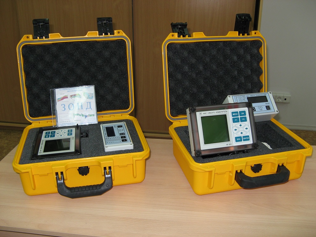
- ZOND software system for processing the results of electrical sounding and profiling.
- Hardware and software AMC-1 complex to carry out field survey methods VES, EP, EP.
- Providing training courses in the use of hardware and software system AMC-1 and ZOND.